
ViaSense AI
Automated Pothole Detection & Geographic Information System (GIS) Platform. Transforming raw edge telemetry into actionable municipal intelligence.
Request a DemoThe Command Center
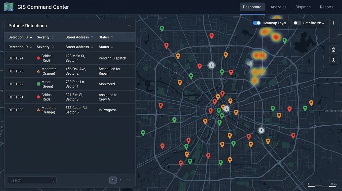
Designed primarily for local government authorities and maintenance dispatchers, our map-centric approach provides a bird's-eye view of your entire road infrastructure.
- Interactive, full-screen map interface.
- Dynamic data clustering at high zoom levels.
- Actionable points color-coded by severity (Minor, Moderate, Critical).
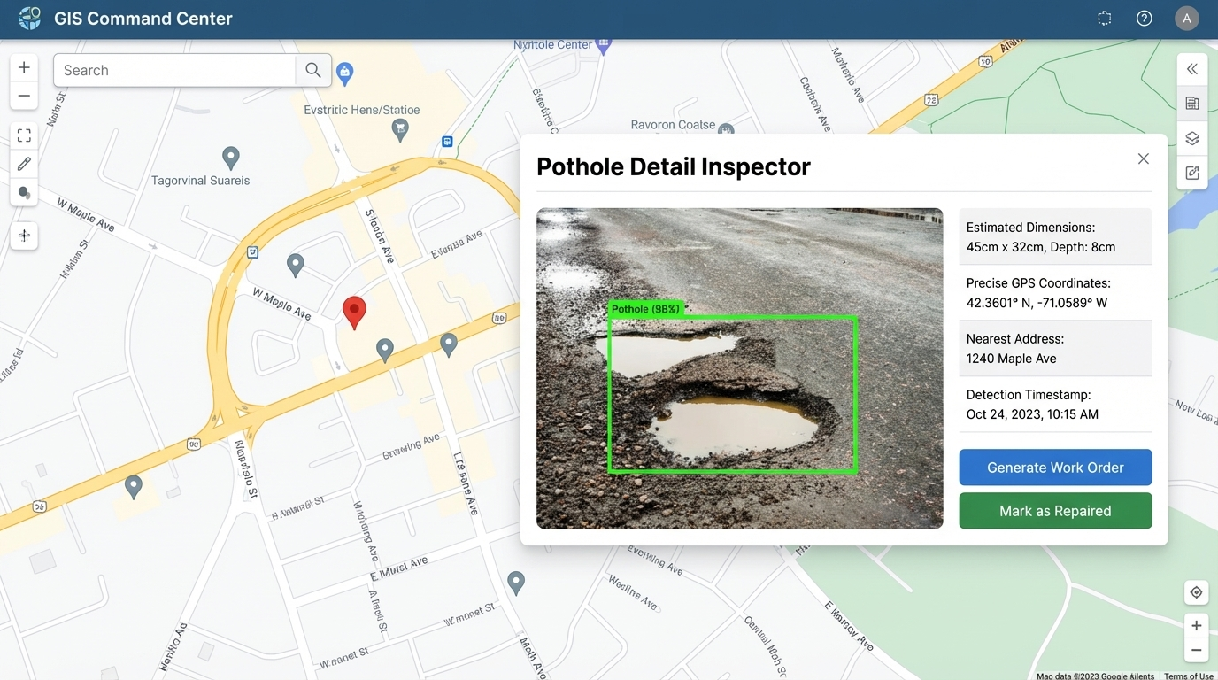
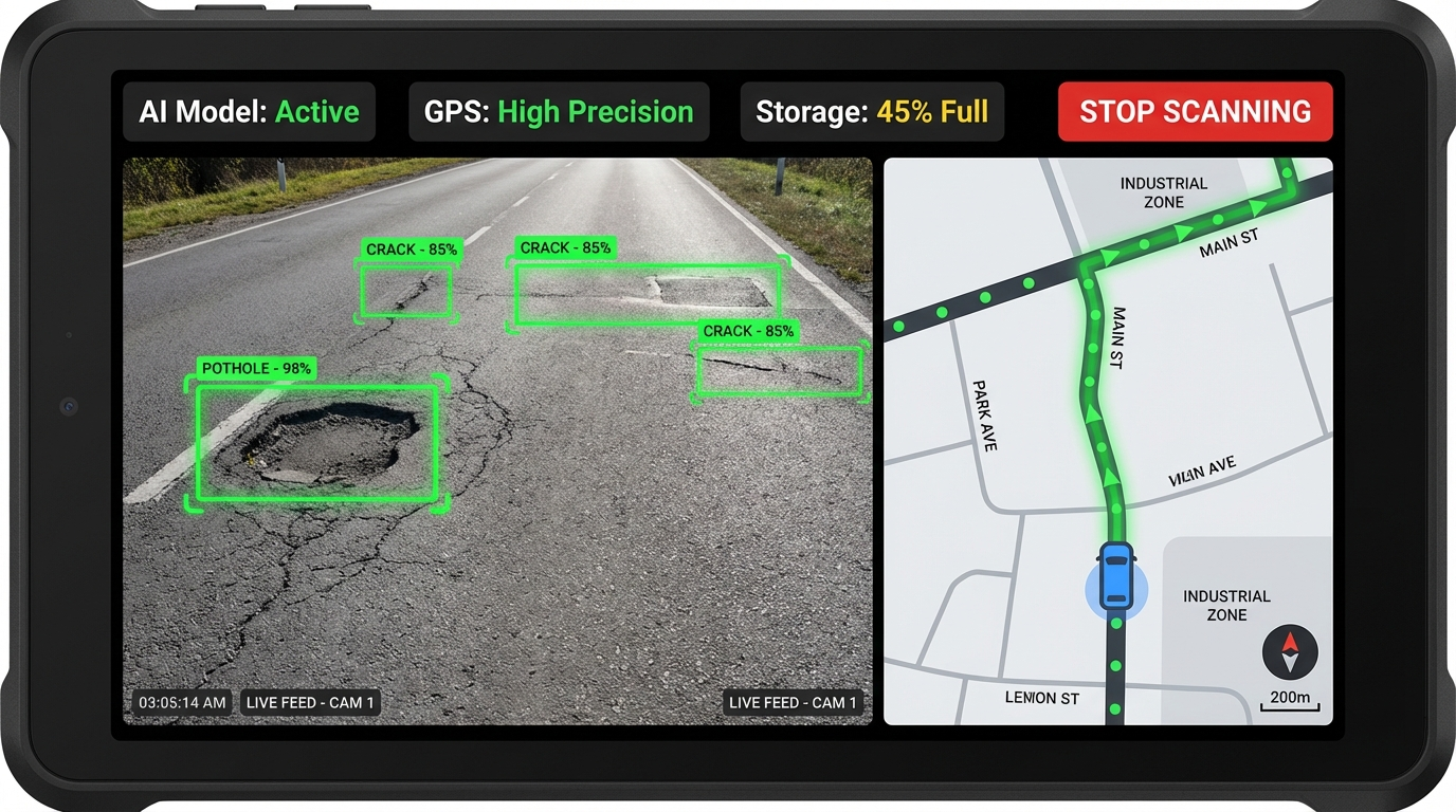
AI-Powered Detail Inspector
Dive deep into any detected road defect. Clicking a map pin opens a comprehensive view combining raw visual data with AI analysis.
- High-resolution original imagery from roving vehicles.
- AI-overlaid bounding boxes pinpointing the exact defect.
- Estimated physical dimensions (width/depth).
- Precise GPS coordinates and detection timestamps.
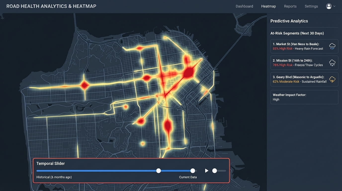
Predictive Modeling & Heatmapping
Move from reactive patching to proactive paving. Our advanced machine learning trends turn historical data into future foresight.
- Heatmapping: Visualize road degradation density over time to prioritize major paving projects.
- Degradation Modeling: Predict which minor cracks will develop into critical potholes based on traffic volume and weather patterns.
- Anomaly Verification: Group repeated detections to eliminate false positives like shadows or debris.
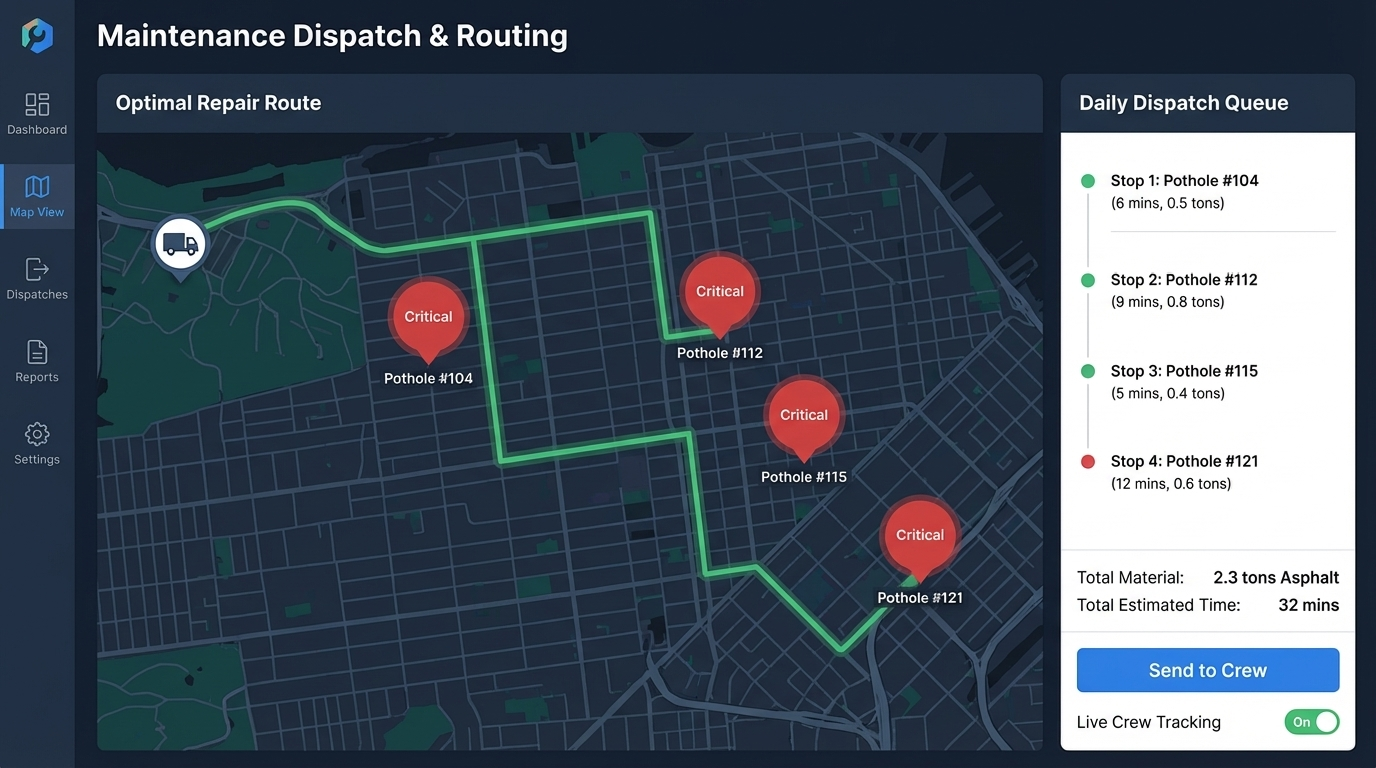
Smart Dispatch & Route Optimization
The platform doesn't just find problems; it helps you fix them efficiently by integrating directly with municipal operations.
- Route Optimization: Automatically group nearby critical defects to calculate the most efficient daily route for repair trucks.
- Patch Quality Assessment: Automatically grade the repair work on the vehicle's next pass over a "fixed" location.
- Automated Work Orders: API hooks seamlessly generate repair tickets in ERP systems like SAP or Cityworks.
Technical Operations & Data Pipeline
A robust back-end architecture designed to handle high-frequency telemetry from roving vehicles, ensuring reliable edge processing and scalable cloud storage.
Edge Processing (Vehicle-Side)
Hardware runs lightweight Object Detection models (e.g., YOLOv8-edge) locally, capturing defects in real-time while filtering out "empty road" frames to conserve bandwidth.
Fleet & Sensor Health Monitoring
Maintain total visibility over your active roving vehicles. Monitor camera status, GPS signal integrity, and connection health to ensure uninterrupted data collection.
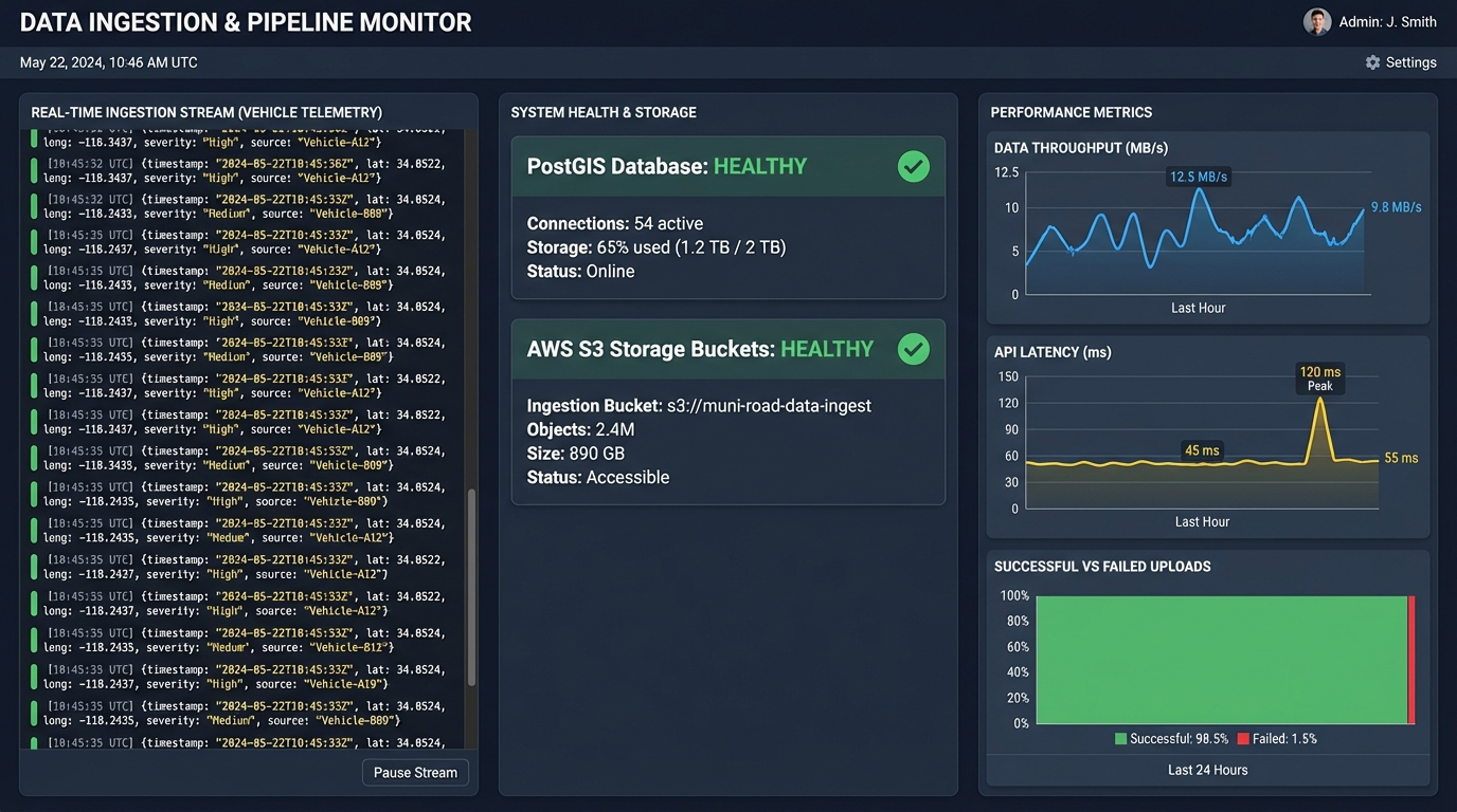
High-Frequency Ingestion Pipeline
A resilient RESTful/MQTT architecture seamlessly ingests massive JSON telemetry payloads containing spatial coordinates, severity scores, and image routing data.
Ready to modernize your infrastructure?
Contact us to discuss how ViaSense AI can be integrated into your city's maintenance ecosystem.
Contact Sales